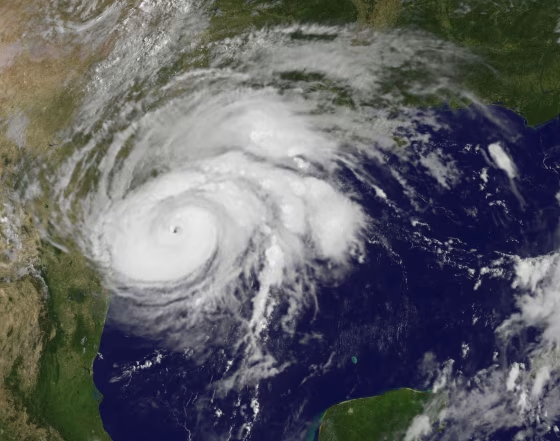
The National Weather Service on Thursday issued an El Niño watch for next fall and winter, raising the prospects for cooler, wetter weather across most of the United States and a significantly milder late hurricane season.
The weather service's Climate Prediction Center estimated the chance for an El Niño — a cycle that begins when warm tropical Pacific water moves east — at 50 percent during the fall, rising to 65 percent in the winter.
"The forecaster consensus favors the onset of El Niño during the Northern Hemisphere fall, which would then continue through winter," the climate center said in an advisory. "These forecasts are supported by the ongoing build-up of heat within the tropical Pacific Ocean."
An El Niño — "the little boy" in Spanish, a reference to Jesus, so-called because the Pacific Ocean near South America is often at its warmest around Christmas — can cause increased rising air motion in the atmosphere, often leading to above-average rainfall in the eastern Pacific Ocean. That, in turn, can shift weather patterns around the world.
Related

One of the common effects is to shift the prevalence of tropical storm conditions away from the Atlantic Ocean, potentially reducing the number of storms this Atlantic hurricane season, which began June 1, the climate center said.
As recently as earlier this month, the National Oceanic and Atmospheric Administration estimated a 75 percent chance that this year's Atlantic storm activity would be normal or even above normal.

 FOR SUBSCRIBERSCBP leaders cut out of Trump ad buy decision








FOR SUBSCRIBERSA harrowing ordeal aboard an Israel-bound plane





But Kerry Emanuel, a professor of atmospheric science at MIT, told NBC News at the time that emergence of an El Niño could change that prediction.
FOR SUBSCRIBERSCBP leaders cut out of Trump ad buy decision
FOR SUBSCRIBERSA harrowing ordeal aboard an Israel-bound plane
"We know that that affects hurricanes," Emanuel said. "El Niño, in particular, suppresses Atlantic hurricanes."
But nothing comes without a cost. The climate center said the trade-off is that, at least in the southern half of the United States, the chances of severe winter weather usually increase.