As much as it's fun to learn about meteorology through real weather events, please be careful and I hope everyone stays safe through this serious storm.
It seems like just yesterday we were scoffing at the wild divergence in weather models for the approaching snow and now we're facing yet another historic weather event. Where the heck did this come from and why has it been so hard to predict?
First off, let's review what we know about nor'easters. We know it's warm, moist air from the south running into cold air from Canada. Right?
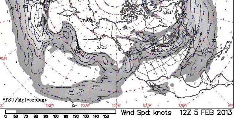
What else we know is that the Jet Stream is what's driving both the cold and warm. Specifically, the Polar Jet for the cold and the Subtropical Jet for the warm. Wikipedia gives us some handy aids for visualizing those particular forces
From my colleague Alastair I learned that the cold ingredient is an Alberta Clipper. That means warm, moist air started from the Pacific and headed across Canadian mountain ranges all the way to where the Rockies reach into the south of Alberta (ahem... that's the second province from the left). The air dumps its moisture on the way up the mountains and warms on its way down the east side. As it comes off the Rockies (see also, Chinooks winds) it hits the cold air that's been sitting in the Canadian prarie and a storm forms that heads across the U.S.
(I know from my past weather posts that many of you are well versed in weather phenomena, so hopefully you can help me understand the role of Arctic Oscillation in this whole concoction. It looks like we're in a generally negative trend so does that explain the trajectory of the Clipper running into the U.S. instead of keeping a more northerly bearing?)
Ok, that's enough theory, let's see if we can go back and watch the birth of Nemo.