The storms that spawned a spate of deadly tornadoes over the weekend puff up like mushroom clouds in an animation assembled from weather satellite imagery.







 FOR SUBSCRIBERSA harrowing ordeal aboard an Israel-bound plane







FOR SUBSCRIBERSThe debate over AI’s future rages on both coasts

NASA assembled the time-lapse video of the tornado outbreak from satellite images captured between Saturday night and Monday morning.
The storm system swept through the central and southern United States, hitting Arkansas hardest, and the regional death toll was expected to rise as emergency officials took stock of the devastation. In the video, "we are seeing the formation of supercells," NASA spokesman Rob Gutro told NBC News. "The tornadoes are beneath the supercells."
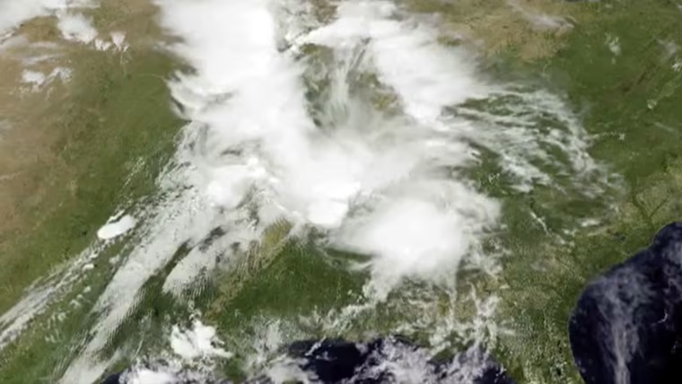
To create the video, the GOES Project at NASA's Goddard Space Flight Center in Maryland started with cloud data from the National Oceanic and Atmospheric Administration's GOES-East satellite, which watches the weather from a fixed orbital position about 22,000 miles (35,400 kilometers) above Earth.
FOR SUBSCRIBERSA harrowing ordeal aboard an Israel-bound plane
FOR SUBSCRIBERSThe debate over AI’s future rages on both coasts
The infrared and visible-light readings from GOES-East are combined with true-color imagery from instruments aboard NASA's Terra and Aqua satellites, producing pictures that let researchers and forecasters track the storm.
The resulting 29-second animation shows 38.5 hours' worth of weather, starting at 8:15 p.m. ET Saturday and running through 10:15 a.m. ET Monday.