
Following storms and floods that turned deadly over the holiday weekend, flood warnings remained in effect across Central Texas on Monday.
Flood watches are in effect until 7 p.m. CT and cover areas that include Austin, San Antonio, Kerrville, Killeen, Brady, Fredericksburg and Uvalde.
Some of these areas had already experienced slow-moving storms Monday morning, but more were expected throughout the day. These storms are likely to drop another 2-4 inches of rain onto an already saturated region. Some localized areas could see 6 inches or more. Conditions are expected to improve Tuesday as stagnant, high-moisture weather systems finally move toward the east.
Some regions in the mid-Atlantic are also facing risks of flooding. On Sunday, Tropical Storm Chantal flooded parts of North Carolina, where more than 10 inches of rain fell near the Chapel Hill area. The Haw River, near Bynum, North Carolina, crested to nearly 22 feet, the highest crest on record there, as a result of those heavy rains.
Chantal has since been downgraded to a post-tropical cyclone. It’s expected to move north into the mid-Atlantic, where tropical downpours could also result in flash flooding in urban areas in eastern Virginia up through northern New Jersey.
Experts also warned that coastal regions could experience other weather-related threats, like strong surf and rip currents.







 FOR SUBSCRIBERSA harrowing ordeal aboard an Israel-bound plane







FOR SUBSCRIBERSThe debate over AI’s future rages on both coasts

FOR SUBSCRIBERSA harrowing ordeal aboard an Israel-bound plane
FOR SUBSCRIBERSThe debate over AI’s future rages on both coasts
Warm temperatures are hitting other parts of the U.S. Some 30 million people in the Northeast — including in Philadelphia; Boston; Hartford, Connecticut; Albany and Rochester, New York; and Burlington, Vermont — were under heat alerts.
Temperatures in the high 80s and 90s were expected in some places, with maximum heat index reaching 100 in Philadelphia.
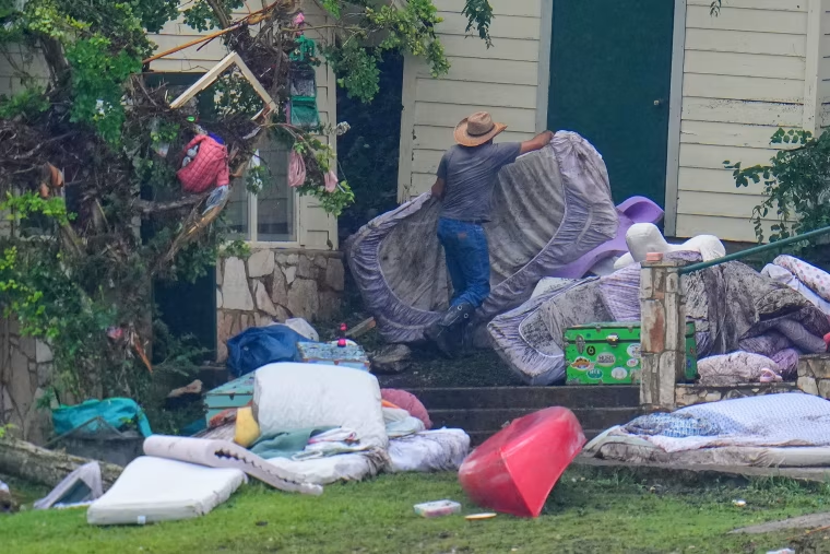
But the nation's focus remains mostly on Texas. As of midafternoon Monday, at least 90 people had been confirmed dead from the weekend storms. Flash flood warnings over the long weekend were issued when most people were sleeping and unlikely to respond. Thousands of people were left scrambling.
Storms can stall over land, dropping heavy rains that can result in major flooding, as happened over the weekend in Texas' Hill Country. Overnight on Thursday and Friday, heavy showers fell across Central Texas, exceeding 20 inches in some places. On Saturday, stalled storms prompted a flash flood emergency overnight. Some areas experienced swells of up to 2 feet of water.
In 2017, Hurricane Harvey hovered over Houston for days, drenching the city and surrounding metro areas with nearly 50 inches of rain amounting to trillions of gallons of water. The storm caused billions of dollars in damage.
